


Bullfox
-
Posts
1,021 -
Joined
-
Last visited
-
Days Won
4
Posts posted by Bullfox
-
-
Leaving Bolder City, KBVU. Down there off the right wing. Its Orbx pay ware in P3D. Like all my Orbx scenery I originally installed it in P3D5, and moved it all over to P3D6 with out much problem.
Heading East to KSEZ.
-
 4
4
-
-
Thanks guys!
-
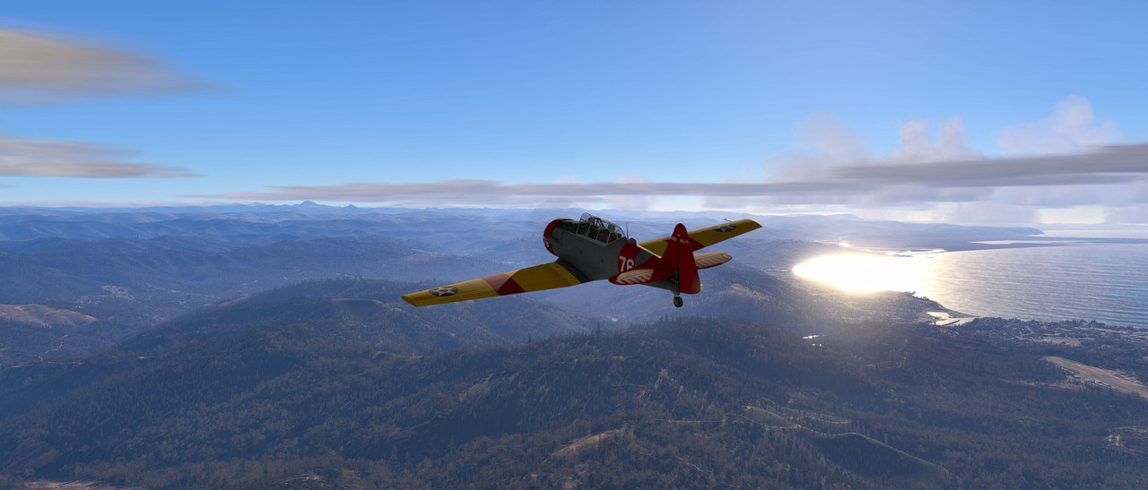
About 0900, 1-11-24 on a flight in Southern Oregon from Brookings to Medford. This is a few minutes out of Brookings. I don't often see stratus clouds with Rex Skyforce,
-
2
-
-
Today, on the LM P3D forum I got a message back from LM that the will fix the problem flight plan loading in the next update.
-
1
-
-
-
-
Some of the terminal buildings in Portland or either missing or mis-located. A large number of jetways are not connected to any building. But its a large airport and other areas look fine.
-
Thanks Nick. I'm running P3D6.18. Sometimes it would display a black building sometimes it would display a building with your texture from P3d4, which I think may be the original FSX texture , and I don't have a clue what makes the difference. Lately the program has been displaying as per your above post. So now, I start a flight in Medford with a saved flight that displays the terminal with the above texture, and then change to whatever airplane I want to fly.
Some of the other airports in Orbx True Earth where displaying the terminals either black or missing entirely. I will check around and see how they display now. Also, I suspect another minor update shortly to clear up the problems with IFR flight plans.
P3D6.18 is great! Its capable of displaying absolutely beautiful scenery. I hope you guys are working on clearing up some of the minor problems in True Earth areas, and will be adding new airports in North America. One way or another, 2024 is going to be a great year for flight simming.
-
Really curious. Sometimes it loads the FSX version as above. Sometimes it loads just a black building with no texture.
-
Great Shots!
-
1
-
-
Now two people on the LM forum are reporting this problem.
-
The aircraft is from Golden Age simulations. I have loaded three of their aircraft into P3D6.1 with no problems. Since this is True Earth Northern California I just assumed it was stock Orbx because of the animated sweepers. Frankly it maybe KGOO or KG zero, zero. If you ask the program for Grass Valley, California airports it comes up as the Nevada county airport. Like I said, I have never before seen that particular building. The airport is fairly well detailed. Some of the stock Orbx airports seem to show more details in P3D6 than before.
Iain, you post such excellent shots in MSFS, you should post some shots in P3D6.1. The lighting makes it possible to get some truly stunning visuals.
-
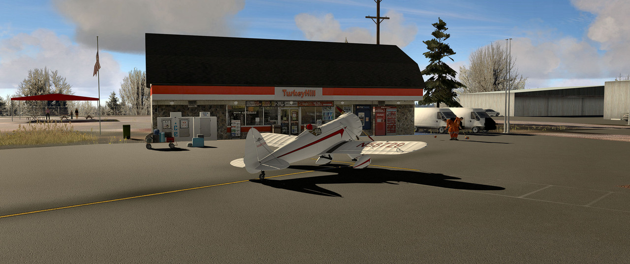
This is at the Grass Valley airport, KGOO, in Nevada County California. First time I have seen this airport building. Note the sweepers. Must be sweeping up turkey feathers. May have been a prop strike, but it wasn't me.
-
5
-
-
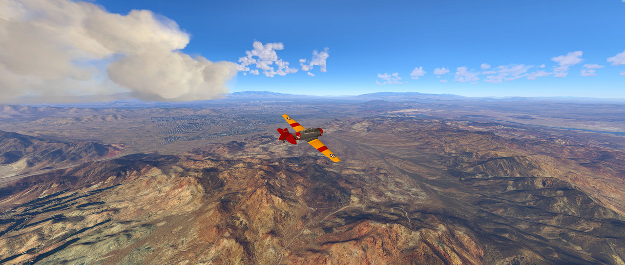
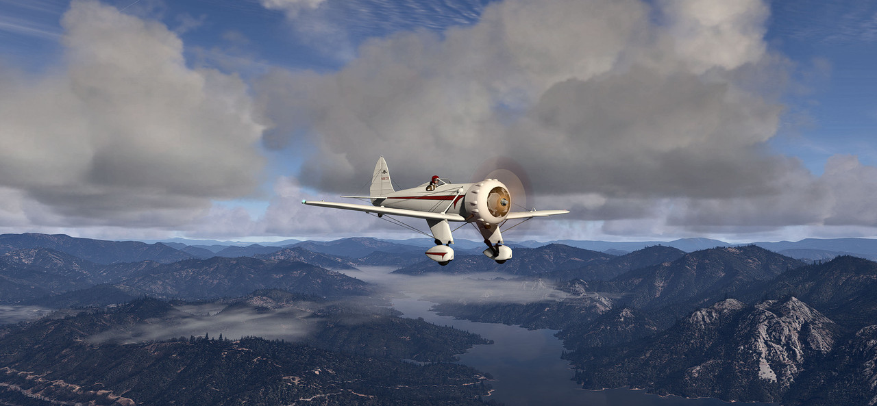
This is the Golden Age Simulations Super Ryan above Lake Shasta in Northern California.
-
6
-
-
Really Beautiful Shots!
-
2
-
-
Now a guy on the LM P3d forums is reporting the same problem. I would very much appreciate if someone here would try to duplicate the problem. Just use the In program flight planner. Enter the departure and destination airports, GPS routing and ask for an IFR light plan, and ask the program to calculate IFR altitude. It will give you an IFR altitude, i.e., not at a 500ft interval. Save and Load.
When you ask for clearance at the gate, it will not give you an IFR clearance, at will ask you what direction, N,S,E,W, you want to fly. After you taxi out to the runway and ask for takeoff clearance it will say it is clearing you VFR. If you want to keep going after that, once you take off you can ask for IFR clearance and it will give you an IFR clearance, and clear you to the flight plan altitude. It will not change your routing along the way. The bigger problem starts once you get near your destination. The ATC will clear you to descend but won't route you to your approach. In fact it will fly you right over the airport at your approach altitude. Thanks for any help anyone can give. Mainly, I'm trying to confirm whether the problem is my installation or a problem with P3D6.18
-
I posted the problem on P3D forums. Waiting for a response. With plan G does P3D6.1 direct you to your approach points. In other words does the IFR sub routine work correctly in p3d6.1? Knowing that would be helpful since it tells me its still in the software I just cannot activate it. . So far nobody else has brought up this problem so I am begging to think it is corrupted in my installation.
-
Most of the time I just pick the starting point and destination, fly direct GPS and let the system decide the altitude. I usually do that for both IFR and VFR. The problem is only for IFR.
-
I'm just using the in program flight planner.
-
Since updating to P3D6.1 I have been unable to initialize IFR flight plans before taking off. I load an IFR flight plan from the flight planner window but when I get ready to take off the flight plan is VFR. Once off the ground I can Initialize the IFR flight plan, but the program does not do any heading changes or routing. All it does is call out altitude decreases when I get close to the destination. Any idea what the problem is?
-
Thanks to all. Merry Christmas too.
-
1
-
-
Do you get that with different airplanes and/or in different areas?
-
1
-
-
I'm using Rex Sky Force. I had it in FSX and earlier versions of P3D. I though I might have to redownload it when I went to v6, but Sky Force found the v6 installation on its own and runs without any problems. The weather in southern Oregon has been really changeable this December, mostly cloudy, rainy, and unseasonably warm. But yesterday when I took this screen shot the weather was nearly clear. I was never complexly satisfied with the clouds with Rex, but in P3D6.18 LM added a lot more contrast to the clouds so they display with more range between light and dark. They really look good, but I think that has more to do with LM than with Rex.
-
 1
1
-
-
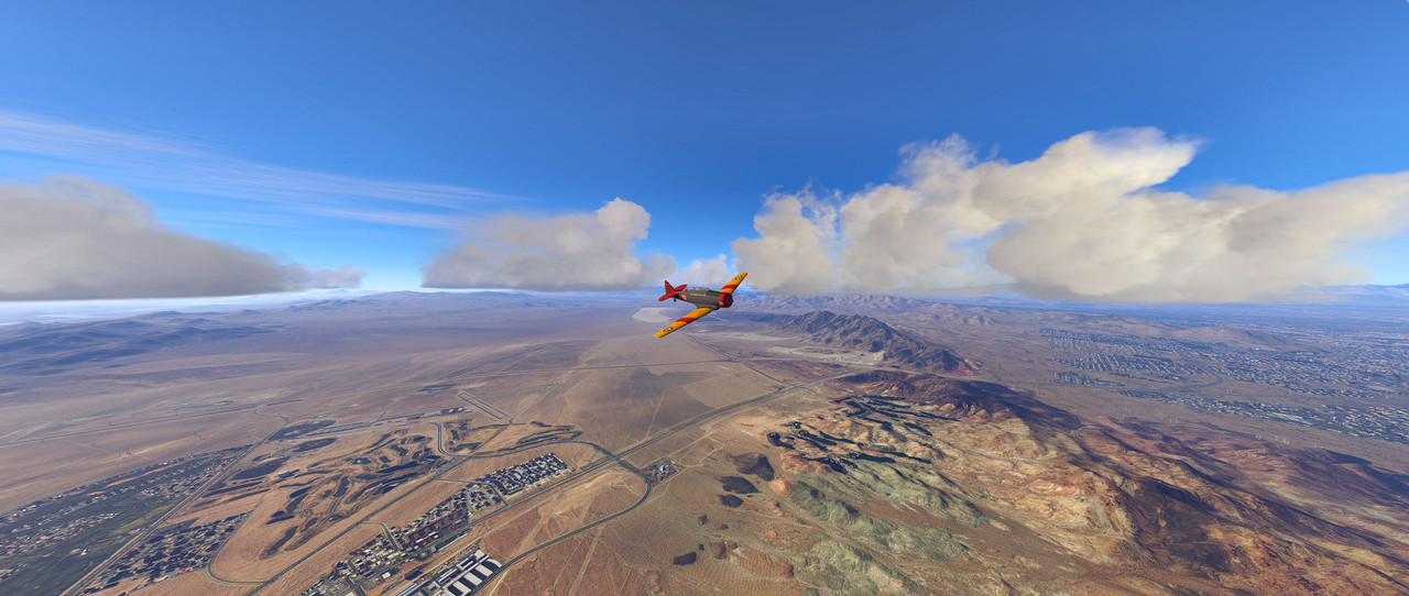
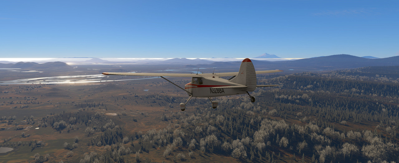
About 10 miles north of Klamath Falls, Oregon, the week before Christmas. Mt. Shasta just to the right of the rudder. KLMT just off the image to the left.
-
8
-


Fooling Around KSEZ
in Community Screenshots
Posted
Not going to be just a touch and go.
Need some altitude.
Going out over the valley.
Looping Up.
Over the Top. Engine quits if I stay inverted but restarts after recovery.
Did some decent rolls and a nice hammer head, but that was enough. This is on base leg then the final via the backdoor, runway 3, through the "V" in the hillside.